|
Towns, Trains and Trails of Nevada 2004 Page-6 |
||
|
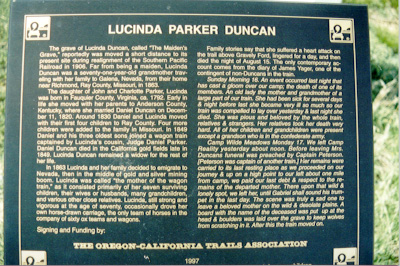
Lucinda P Duncan 1793-1863. The marker reads, in part: The grave of Lucinda Duncan, called "Maiden's Grave", reportedly was moved a short distance to its present site during realignment of the Southern Pacific Railroad in 1906. Far from being a maiden, Lucinda Duncan was a seventy-one-year-old grandmother traveling with her family to Galena, Nevada, from their home near Richmond, Ray County, Missouri, in 1863. Family stories say that she suffered a heart attack on the trail above Gravely Ford, lingered for a day, and then died the night of August 15. She was buried on the 16th, the diary of James Yager, one of the contingent of non-Duncans in the train wrote; "...The scene was a truly sad one to leave a beloved mother on the wild & desolate plains. A board with the name of the deceased was put up at the head & boulders was laid over the grave to keep the wolves from scratching in it. After this the train moved on." A sad, but often true story of the west that is seldom told.
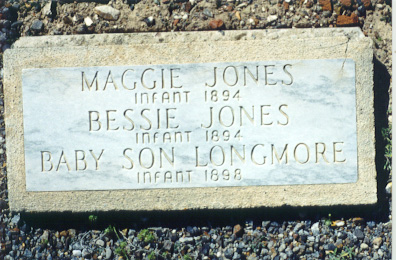
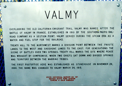
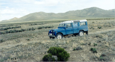
Above: A sad grave we found near Lucinda. Heading west from Gravelly Ford on a gravel road we passed the UP heading east near Beowawe. Soon we were back on I-80, our next stop was Battle Mountain for gas and a quick look at old Highway-40. We planned on seeing a few more sights between Battle Mountain and Winnemucca, but due to the late hour we thought it best to get going. Once again the 109 was hammering along at 75… about 5:00 pm Andrew said "enough", thus we stopped at Valmy rest stop to feed him. VALMY: Overlooking the old California Emigrant trail, Valmy was named after the Battle of Valmy in France. Est. in 1910 by the Southern Pacific Railroad Company as a section point. Valmy served during the steam era as a water and fuel stop for the RR.... marker #167.
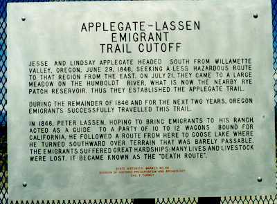
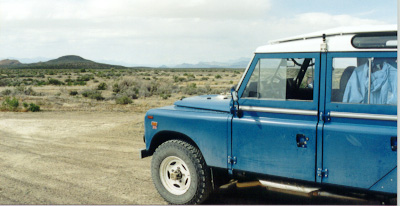
With Andrew’s belly full we headed for Winnemucca for the night, along the way we’d pass a neat section of old Highway-40 stretching from Golconda Summit to the town of Golconda. As we passed the old highway I thought of heading to Iron Point, which lay northeast of Golconda. Iron Point was where the emigrant trail made a left turn to avoid mountains. The next morning I had some Rover work to do. We had noticed an increase in the exhaust noise en route to Winnemucca, upon looking I noticed one bolt missing from the header flange and the other five not very tight. In 10-minutes the Land Rover was ready to roll, this day however would be very long and the roads would vary a great deal. West of Winnemucca lies the town of Imlay, once known as Humboldt Meadows (or Lassen Meadows). It was here that the emigrants on the California Trail, later known as the Donner Route, would have to make a choice; 1) Continue west along the Donner Route to Sacramento, 2) Continue west to the Humboldt Sink then turn left onto the Carson River Route, or 3) Turn right and head west (x NW) via the Applegate-Lassen Trail. After 1847 a painted barrel was to be found here at the meadows, in it was mail and notes from those who had passed before. Those traveling east bound would take letters from the barrel addressed to families in the east... thus it became the first mailbox along the Trail. Interested in the Applegate-Lassen trail? Watch for our report here, as we are re-tracing the trail in 2007.
|
We chose #3… to turn right via the Applegate-Lassen Trail. We have all traveled the Donner Route, as Interstate-80 is paved right over the top in most places, the old wagon routes became a road for Model-T’s and later became Highway-40, and later I-80.
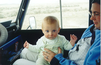
We progressed west along the trail, overtaking watering holes that once fed thirsty Oxen and emigrants alike… we saw dust ahead, thus picked up the pace. As we arrived at Rabbithole we caught two BLM vehicles. From Rabbithole we’d change direction yet again, now we’d follow Noble’s Route to Gerlach instead of heading across the Black Rock Desert. We arrived at Bruno’s Shell around 3 pm and tanked up, then took a chance and headed north up Highway-447, a route we’d never been. At Squaw Creek Reservoir we stopped to feed Andrew, then continued on.
85+ miles from Gerlach we hit Cedarville, California. The ride north x northwest had been interesting, to say the least. At Cedarville we turned west and crossed over Cedar Pass on Hwy-299, stopping in Alturas for gas. Just outside of town we stopped once again to feed baby. The sun was quickly setting now, and for the first time in our weeklong trip we’d be running in the dark… and home was still a long way off. Heading west on 299 for the first time was an interesting ride, one I’d love to take in a fast car or motorcycle, as though the 109 has enough power for some pretty high speeds, it’s no sportscar, thus 299 became slow going in some places. 299 is a lonely road on a Saturday night too, we couldn’t find anywhere worth stopping to eat, thus we snacked along the way. Finally we made Redding, where we’d get both gas and dinner. Redding put me off, as there were far too many people in the once small community. We now set out for the long nasty and boring ride home via Interstate-5, home being some 227 miles. The 109 ran a steady 75-mph all the way home without re-fueling or changing tanks, getting 12.7-mpg (main tank is 20 gallons). We arrived home just after 1:00 am, and though we were both tired from the days run, we really enjoyed it… and hope to navigate our way around Nevada again very soon. Interested in seeing Nevada with us? Drop us a note. Click here to see more on Railroads from another era. Click on the following link to leave... www.offroadexperience.com or www.westcoastbritish.com |
|